Every time we see Alofi, Niue (pronounced new way), on the itinerary, we say why? Especially on a Sunday, when most everything is closed. Perhaps it is because there is nothing else on the way towards Auckland, or for the “bragging rights” to say you have been there. Different strokes for different folks.
Niue is an up thrust coral reef that rises vertically out of the ocean. Perhaps, it may be the largest of its type in the world. Located midway between Tonga and the Cook Islands, it is a long way from anywhere. The land mass measures 100 square miles, and there are probably less than 1400 people living here. Although there is little beachfront, if any at all, there are ravines, gullies, and sea caves. That makes this place a destination for scuba caving diving.
The capital is Alofi, from what we saw, the only village on the entire island. It is the world’s smallest self-governing state, overseen by New Zealand. It also suffers population decline, because once the kids reach high school age, most are sent to New Zealand to be schooled. Many of them never return to live. So today, it is a fact that more Niueans live in New Zealand than on the “rock”. That brings Alcatraz in San Francisco Bay to mind because it has been referred to as The Rock. Not much different, except this rock is bigger. Anyway, this info was shared with us from a teacher who explained how she and her husband came here on a 4 year contract from New Zealand.
Captain Cook landed here in 1774, only to find it was inhabited by savages that did not take kindly to British invasion. He never came back, naming it Savage Island. No one came back to this island for 80 years. These days, the natives offer tours for whale watching or swimming with the dolphins, obviously, not this time of the year. Our take on the tourist season, is that it is over now. All of the restaurants and lodges we passed were shut up for the season. And besides, it was Sunday, a day for church services. We have a feeling that some of these businesses are run by folks from New Zealand, and they have left the rock until it starts up again later in the year. We could be wrong.
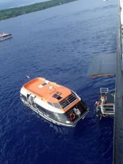
Getting over to shore by tender boat was much easier than in the past. Skipping breakfast once again, we were on the first boat over. Never know when, or if the transfer process may be suspended. We waited while the officials boarded, and cleared the passengers right after 8am.
It was going to be a very warm, humid and overcast day, with a chance of rain. It had been raining fairly heavily when the ship came into the bay this morning, so we packed the umbrellas and lots of water. Good thing.
The landing at the pier can be dicey, but with the help of the shore team, we timed the wave with the lowest, slippery concrete step, and jumped off the boat. Steep stairs took us up to the dock area. Once up the driveway to the main island road, it all came back. Not much was here, and all of it was closed. Locals were handing out maps of the island, which were far better than the ship’s map. However, most all of the info on the map must have been pre-cyclone 2004, when Cyclone Heta hit the island, destroying much of its infrastructure. So many of the lodges, cafes, and bars simply were not there as listed. Nice map, but not necessarily correct.
The locals were down at the landing with their vehicles, offering tours to the folks. Some passengers had arranged for an island tour, and had their cars and drivers waiting for them. This would have been the way to go, because from what we saw, no rental places were opened, at least, not until after church was over.
We did hear church bells ringing from a nearby tower. Although our info said we could hear their choir singing on Sunday morning, we heard nothing today. And we strolled past three churches. On the front of our newsletter, it was suggested that the passengers may join the church services, so dress appropriately. Also, it was warned that the island’s tradition forbids swimming near the village greens and churches on Sunday. Not a problem, as there was no place to swim anyway. Of course, we were requested not to parade through the village in swimsuits.
Heading off towards the right, we hiked 5 miles, passing the government building, Tomb Point, the cemetery, a golf club, and the international airport, which was located, out of sight, up a road that went up higher. The village of Alofi houses a tiny food market, a vanilla shop, a DVD store, and a meeting hall. We did see one place that offered internet. While on our first visit here, the passengers shut down their entire internet on the island for the day, shutting down the schools for the rest of the day. The schools of the island are located higher in the center of the island. Good place to be if there is a tsunami. Those tsunami warning signs lined the road.
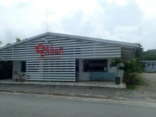
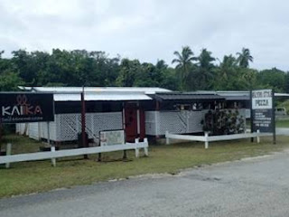
We passed by The Organic Vanilla store, and Utuko Reef. We turned around and found that absolutely no one had followed us. It was brutal hot already at 9am. Continuing on, we passed the Council of Women, Hala Tahi Opaahi Sea Trek, The Ekalesia Church, and a Pizza Place. Oh boy…..pizza. Even the Mini golf Café was closed until noon, but the children’s playground was opened. There are benches there, which provided a good spot to relax for a minute. By the time we reached a very closed Clayton’s Bar, we realized the road was turning inland. This time, we had hoped to find the Matavai Resort, according to the map, located 6 kilometers from the village center. It should have been do-able. But where was it?
We continued further towards a fix it car garage, the fish packing plant, and Hala Tahi Amanau, another access to the water far below. Both of us went down the steep carved stairs that led down the cliff. But when the stairs became a vertical ladder, one of us stayed behind. There is nothing but coral and rocks with caves along this part of the coastline. And the tide was coming in. We could see rather large black fish swimming in the reef waters near the shore.
Further up the road, we came cross the local quarry. This is where they harvest the coral, and grind it into sand for the rest of the island’s roads. On our quest to locate the resort, we went further and discovered where their garbage dump was. In fact, the flies discovered us first, as we were literally covered with them. On the plus side, they did not bite.
The road took a turn away from the ocean, and we seemed to be climbing gradually. We thought we heard a large truck coming with a dull roar. Turned out, it was a massive cloud that was dumping rain in torrents. By the time I said, get the umbrellas out, it was pouring. The noise we heard was the rain pounding down in the forest. Truthfully, it felt wonderful, even though the road was flooded within seconds. It eased up almost as fast as it had begun.
Somewhere along this stretch of the road, a local lady stopped her car, and offered us a ride to the Matavai resort, as she was bringing a couple there already. We declined, but she said she would be back after she dropped off her guests. Asking if it was within walking distance from here, she laughed and said no, you cannot walk there. Way too far to walk she said.
We did not go much further, knowing that if there no cars, there would be nothing close. On the side of the road, at the base of a big tee, was a small garden nome, a concrete statue. He had a beard and was holding a white rolling pin. Taking that as a sign to turn back, we did. Keeping in mind, we had 5 miles to get back, and we were running low on water, that was the best choice.
It was about ½ hour later that the same local lady pulled over to ask us if we needed a ride. It had taken her that long to drop off her guests, and drive back. The more we thought about it, perhaps these maps are mismarked to keep the public out of the resort.
Most everyone that was just coming over to the island met us on the road, asking what was up the road. We told them what we had seen, and just with the mention of the garbage dump and flies, most of them turned back. The only high light on the way back, was seeing a giant coconut crab being shown to some tourists. This was close to the home of the man that made money for photos of the crab in his front yard. That huge giant must have died since we were here last. The Pizza place was still closed, and there was little chance of getting something to drink. Having walked our feet off, we decided to head back home. It was already 1 pm and time for lunch…..just not here. We have had the question about getting sick eating off of the ship. Believe us, we are very picky about where we dine off shore. Usually it is in restaurants that have the most customers, or in hotels. If we’re not sure, we’ll wait until we are back onboard. Street food stalls are something we never do, as it is too risky. One other important concern is drinking the local water. We have learned it is best to stick to the bottled water, soda, or beers. And try to get it served without the ice. It’s not that the ice is bad, but it may have something that does not sit well with you.
The ride back was just as easy as coming over. No problems today. The boat was full of guests that were happy to go back, mostly mumbling why did we go to this island. We are certain that our buddies, Wendy and Steve, will have the most fun. They were going geocaching today, showing us their possible caches they would search for. Having never been here before, they were excited. And we did see some folks packing golf bags over, and head for the small golf course. And we did happen to talk to some ladies that actually found something opened and purchased a t-shirt and a jar of local honey.
Lunch for us was in the coolness of our room. This time we tried cobb salads and a shared roast beef panini. Oh yeah, and three chocolate chip cookies. That was our big treat for the long 10 mile hike today.
The Alofi sail away was at 4:30pm, where during Captain Mercer’s talk, we learned that we will be heading into a weather system that will produce some rough seas and 40 km winds. Some rain too. He asked us to store valuables, and be careful when taking the stairs. Fine with us, as we usually use the elevators anyway. The island quickly faded in the distance, but not before we spotted the coastline, where the wave action produced blowholes that sure looked like whales blowing. Overhead, we heard the chattering of three birds. Getting a shot of them, revealed the long tails of the tropicbirds. Along with a handful of white terns, we saw few birds today.
If they did not serve the honey mustard chicken and a tasty pork chop, we may not have gone to dinner. It would be a short evening for us, because we were admittedly tired. The Knights, a trio of British singers, brought their show back to the lounge tonight. We do like the type of music they sang, but way too tired to stay up after 10pm.
Walking the promenade for some air tonight, we saw that every lounge had been stacked and secured to the inner railings. An indication that things may get bad through the night and tomorrow. Captain Mercer usually sticks to the safer side of caution.
The clocks had to be put ahead 24 hours tonight as we will be crossing the International Dateline, and literally losing a whole day in the process. So January 29th will not exist for us, and we will begin tomorrow as January 30th.
This evening’s pillow message read: “Fill your life with adventures, not things. Have stories to tell, not stuff to show.” Wish we had read that 40 years ago, before our house became a mini-museum of stuff!
Bill & Mary Ann


